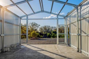
“It’s just a shed… how hard can it be?”
That’s how most shed projects start. You’ve got the land, you’ve got a rough plan in your head, and you’re thinking it’s a matter of getting a kit and lining up the build. But for a lot of people, that’s where things start turning sour.

When people think about adding value to their property, they often focus on kitchens, bathrooms, or landscaping. But what if one of the simplest and most cost-effective ways to boost your home’s value and appeal was something as practical as a shed?
Read More
When people think about adding value to their property, they often focus on kitchens, bathrooms, or landscaping. But what if one of the simplest and most cost-effective ways to boost your home’s value and appeal was something as practical as a shed?
Read More
When people think about adding value to their property, they often focus on kitchens, bathrooms, or landscaping. But what if one of the simplest and most cost-effective ways to boost your home’s value and appeal was something as practical as a shed?
Read More
Enquire Now Choose your prize: Land – Sea – Travel – Cash Plus 18 minor prizes valued at $18,000 to be won. The minor prizes include 9x $1,000 fuel vouchers and 9x $1,000 ‘Shed Setup’ (Harvey Norman) Vouchers. Total of $68,000 worth of prizes up for grabs Order a shed from Ranbuild for your chance…
Read More
Why Compromising On Shed Design Now
Could Cost You Thousands In Modifications Later (And How To Get A Fully Customised Shed For About The Same Cost As A Standard Shed)

Why Managing Your Own Shed Build Could Cost You More Time, Money And Stress Than You Expect (And How To Get A Fair, Fixed Price That Offers Better Quality, Timeline And Value)
Read More
What Shed Companies Don’t Tell You About True Construction Timelines (And How To Get Your Shed Delivered, Approved, And Built — Faster — Guaranteed)
Read More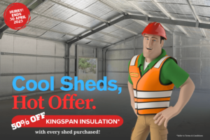
From 01 April to 30 April 2025, Outdoor Steel Solutions and Ranbuild are giving 50% off Kingspan Roof Insulation*! Kingspan is a world-renowned leader in insulation. The Kingspan AIR-CELL insulation range offers supreme thermal performance, with a strong emphasis on energy efficiency. Kingspan AIR-CELL is exceptional in that its extremely reflective foil redirects almost 97% of…
Read More